Monday, August 21, 2006

One Improbable Journey Ends and Others Begin

It was August, 2002, when we climbed our first 4000 footer. The hike up Mt. Tecumseh is one of the more moderate 4000 footer climbs and we had no ambitions that day beyond enjoying that climb. It was simply a natural progression that began when the kids were three and we hiked trails in Waterville Valley, to Sabbaday Falls, and to Smarts Brook. At four they hiked up to the first ledge on Mt. Welch and five they reach their first summits climbing the Sugarloafs. Patience was always the key as we tried to choose hikes that were interesting but within our children's limits. Of course with every hike and with every month that passed, those limits expanded and so did we.

It was not until the first hike of the summer of 2004 that our horizons really began to expand when we met our first "super hikers" on Mt. Pierce. Urged on by our son Jordan, hiking the 48 began to seem possible and we became fully committed to doing what it took to achieve this goal. The truth is that few of the hikes were easy and until the end, our limits were continuously stretched. For many of the hikes we developed our abilities "just in time" as our conditioning and skills continually improved. For those hikes, it seemed as though we could not have completed them any earlier than we did. Hiking these mountains involves preparation, commitment, training, and both physical and psychological conditioning.

In the process Jordan and Kate have become a bit of hiking celebrities with known and unknown hikers as they get ahead of us and interact with others on the trail. Their speed, endurance, and agility are far beyond the norm for their age; they have become among the youngest hikers to ever complete the 48.

We have met hikers who have been hiking these mountains for 60 years. Where Kate and Jordan will be as adults is of course impossible to predict. But if they are still hiking these mountains in 60 years, it will be but a second in geological time. If they keep hiking it will be because these mountains call to them, and in the process of hiking they are in touch within with something larger than themselves.

Jordan and Kate talk already of new hiking challenges and new lists – "100 highest" of New England, "Trailwrights 72," etc. As they talk about bringing their children one day to climb the 48, the generations begin to unfold in a poignant way. A little thought creeps in. How nice it would be as a tradition – one generation after another hiking as a family to be more than themselves.

Descending The Adams Summit Cone

 Posted by Picasa

Looking at Mt. Jefferson

 Posted by Picasa

We Look at Wildcat Where Our Summer Began

 Posted by Picasa

The Great Gulf

 Posted by Picasa

#48 on the Summit of Mt. Adams

 Posted by Picasa

Mt. Adams Looms Ahead

 Posted by Picasa

Mt. Madison to Our Left

 Posted by Picasa

Hardy Wild Blueberries Growing at 5000 ft.

 Posted by Picasa

Jefferson and the Caps

 Posted by Picasa

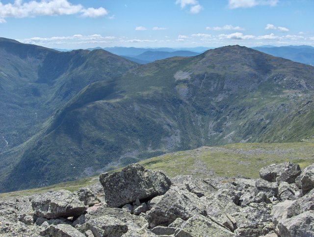
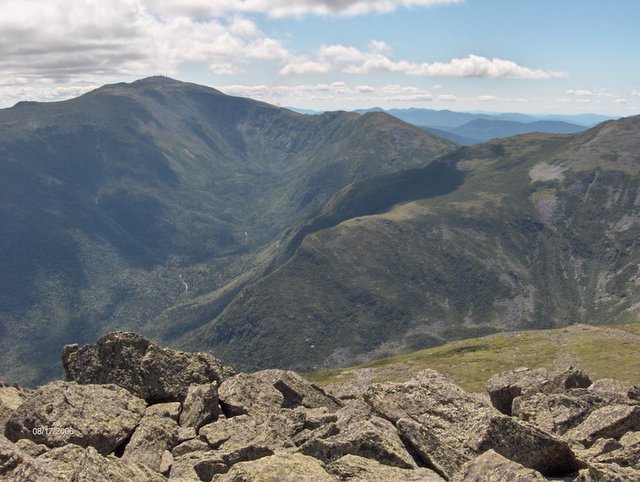
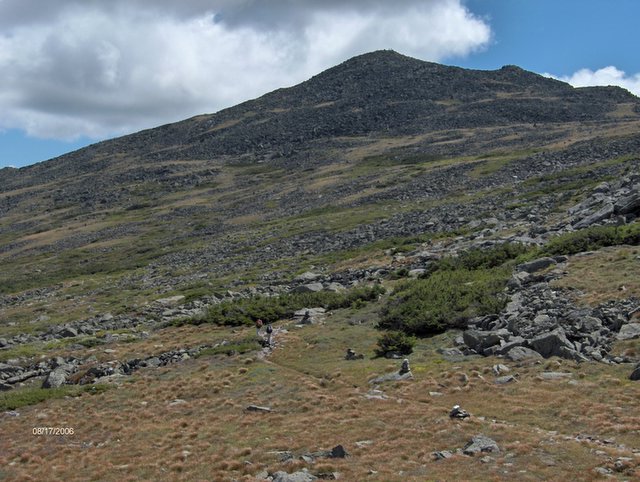
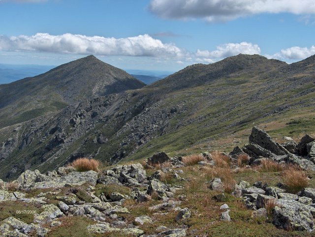
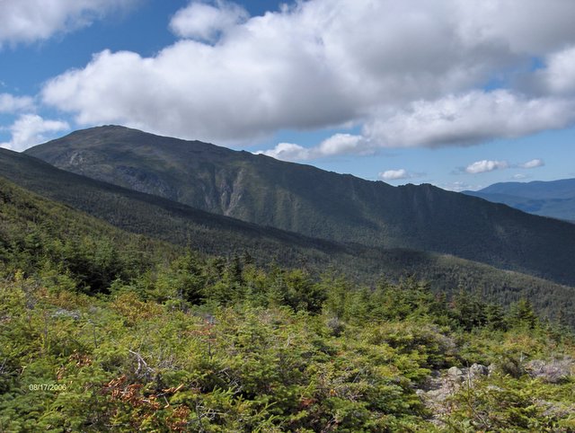
Mt. Adams August 17, 2006

Mt. Adams is the second highest peak in the Whites and the grand views from the top of Adams, on this beautiful day, didn't disappoint. The great weather provided an unusually calm day above tree-line. Usually the winds blow hard at this altitude in the Whites.

However the trail we choose to climb Adams was more difficult than we expected. The trail featured 1.5 miles each way of above tree-line climbing with great views. However we choose the historic Lowe's Path because the AMC guide considers the trail the "easiest" way up to Adams with, in their words, always moderate grades and good footing. Not so! On the way to other destinations we have climbed up two other trails that go to Adams – the Valley Way and Airline. IMHO both are superior in footing. The Lowe's Path features extended sections of steep wet rock which was particularly slow and tedious for Deborah and me on the descent. The kids were always ahead and stopped to wait for us to catch up. For Deborah and me the fatiguing decent took 5.5 hours to navigate the 4.8 miles down. The final 1.8 miles, with much better footing, took only 1 hr, so it took 4.5 hours to descend the rough 3 miles. This was exhausting and the slowest descent on any mountain that we could recall.

The trail was as it "is". We didn't hear the "greensong" today and could never fall into the extended hiking rhythm which can be so enjoyable. The footing was just too tough on this, the longest vertical climb up any of the 48. The mountain though was beautiful and we will return to Adams again but on another trail. #48

Distance 9.6 miles; Climb 4450 ft; Elevation 5799 ft.

Wednesday, August 16, 2006

Boots Back on After Liberty Brook

 Posted by Picasa

The Summit is Viewless But We Are Glad to Have Arrived

 Posted by Picasa

Looking Across at Franconia Ridge From the Slide

 Posted by Picasa

The Slide Begins

 Posted by Picasa

After 8 Miles We Reach The Owl's Head Trail

Posted by Picasa

Finding Trillium on the Bushwack

Posted by Picasa

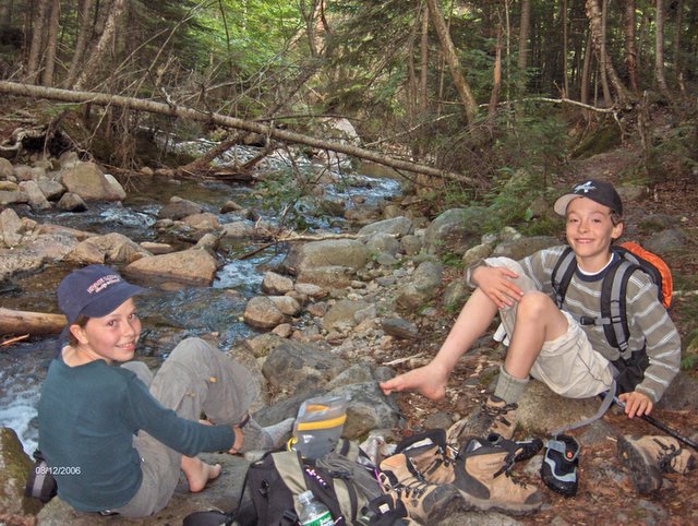
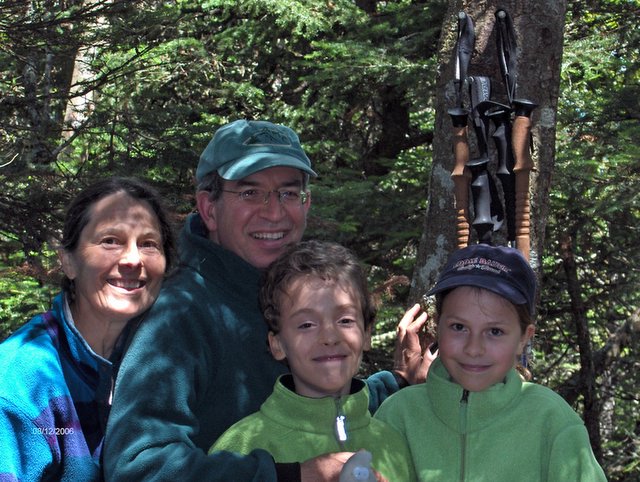
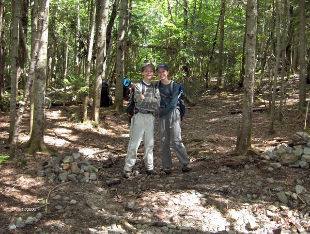
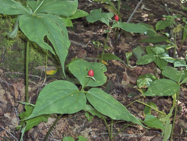
Owl's Head August 12, 2006

We were not looking forward to Owl's Head. A long 17 mile hike with difficult stream crossings, with perhaps the steepest slide in the Whites, and with no view at the top, Owl's Head attracts its detractors. For a smaller group, Owl's Head is admired. I was open to enjoying this peak, but after the hike, count me as a detractor.

I can remember no other hike in the Whites after which I felt beaten. It was not the distance, I could have gone further. It was not the elevation (Owl's Head is a modest, albeit steep, climb). I believe it was a combination of factors more psychological than physical. First, we opted to bypass the first two very difficult brook crossings by following the old angler paths after Franconia Falls. The middle section of about .5 miles had no discernible path and was for us our first bushwhack. Although we had the Lincoln Brook as a guide there were many tributary streams to deal with and there is always uncertainty when bushwhacking. Next we had to decide whether to make the next two high brook crossings by a difficult hop on rocks or "boots off" in our Tevas. We opted for Tevas and I promptly fell on my first step on a mossy rock. No harm ensued. Next there was the uncertainty of finding the Owl's Head path for the final climb. We had heard how difficult finding this unmarked path was. Fortunately this was not the case but it was on my mind. Next we had the climb up. Going up on a steep trail is easier than coming down and this mountain was no exception. But even after the slide ended, the trail was so wet and steep that I was slipping and staggering on almost every step.

At the top we had enjoyable company. Most hikers save Owl's Head for close to the end (of their 48) and today at the summit one man celebrated finishing his 48. He was accompanied by hikers we met at the viewpoint between Middle and South Carter. They were finishing their 48 that day and they were back at Owl's Head to accompany their friend. They remembered Kate and Jordan distinctly. We asked the kids later and they told us that the hiking couple had seen them running up the final approach to the summit of South Carter. I guess that would make an impression! They were so nice that they told us they would love to do our 48th up Adams with us this week. Unfortunately he had to fly out to Seattle.

Soon it was back to the return off the mountain. On the slide, besides the frightening steepness, there was the hazard of loose shale rock being constantly dislodged. I spent most of the slide on my behind. Then there was the bushwhack again, where once again the middle section proved hard (with the added pressure of having to complete with daylight).

I felt no exhilaration at the end of the hike. True, I climbed Owl's Head, but at the end it felt more like I survived Owl's Head. Peak #47

Distance 17 miles; Climb 2900 ft; Elevation 4025 ft.

Monday, August 07, 2006

From Rollins Trail - The "Bowl"

 Posted by Picasa

From Ledges on Mt. Whiteface

 Posted by Picasa

South Summit

 Posted by Picasa

From the South Summit

 Posted by Picasa

Jordan's Stuffy is Relieved the Scrambling is Over

 Posted by Picasa

Mt. Washington From Ledges

 Posted by Picasa

Upper Ledges

 Posted by Picasa

Upper Ledges on Whiteface

 Posted by Picasa

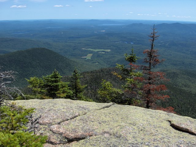
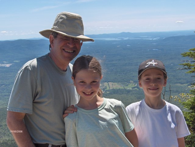
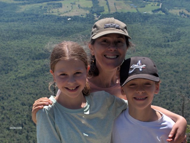
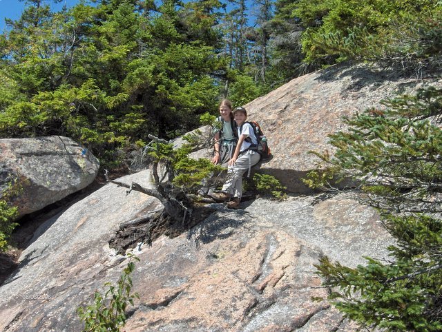
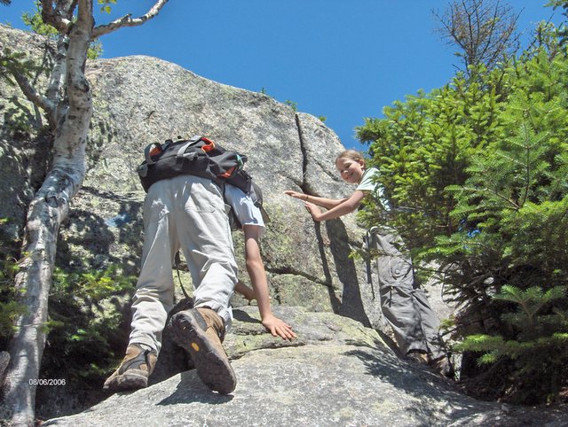
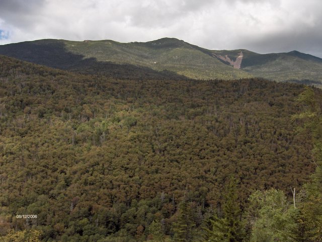
Mt. Whiteface August 6, 2006

Today was a first for us. We hiked back to back days to major peaks. By the end of the day we had hiked around 20 miles and climbed over 6000 ft. in 2 days. Whiteface (the southernmost 4000 footer) was a peak that we had not been eagerly anticipating. The AMC Guide says of the trail that because of the steep ledges that it is one of the more challenging climbs in the Whites. Bob and Geri, the hiking couple we met on Mt. Jefferson told us the Caps Trail up Jefferson was harder. They were right. The hard part of the Whiteface climb was not the warned against ledge scramble but the steep section which begins a mile below the intersection with Tom Wiggins Trail. The open ledges are indeed very steep as promised and as promised require hand scrambling. But we never encountered a section where we thought how we are going to get up this part. We were prepared and what we have learned is that untrodden trail is never as you imagined and almost always not as difficult as the mind imagined.

Instead of coming down the same way we decided to take the 2.5 mile Rollins Trail which goes across the ridge which connects to Mt. Passaconaway. The trail was rough and slow-going in places and we spent more time on Rollins than we had anticipated. The final 3.7 miles was down on the Dicey's Mills Trail which is probably the fastest trail for descent of any serious climb in the Whites. The grades are never steep and the footing is always good. To give you an idea of how good this trail is – Rollins drops 900 feet in 2.5 miles and Dicey's drops 2200 ft in 3.7 miles. Dicey's took us less time. On the drive back we stopped off the beaten path, on the back dirt roads of North Sandwich to visit the Sandwich Creamery for fresh home made ice-cream. Peak #46

Distance 10.1 miles; Climb 3100 ft; Elevation 4020 ft

We Pass This Junction For the Last of 6 Times This Summer

 Posted by Picasa

From Carter Lake

 Posted by Picasa