Tuesday, June 29, 2004


The view from the top of Cannon. You are facing Franconia Ridge. The high peak is Lincoln.  Posted by Hello

Another view from the top of Cannon. The highest peak you can see Lafayette is to the left.  Posted by Hello

From the ledge the view down toward Lonesome Lake. The lake is about 1/2 way up the mountain. Posted by Hello

After the ladder the kids rest on a ledge with a view. Posted by Hello

About 3/4 of the way up we encounter rough climbing culminating in a scramble up a ladder. Deborah shoots from the bottom of the ladder.  Posted by Hello

Mt. Cannon June 28, 2004

Our new camera has arrived and so we are back to doing scenic climbs. Yesterday's climb was to Mt. Cannon, which has spectacular views of Franconia Ridge. You know you are hooked on climbing when you climb Cannon since there is a tram that goes up to the peak.

Slowed by the difficult climb by the ledge and ladder section of the hike (see photos) and by threatening weather (you do not want to be at high altitude when a storm come through) we decided to take the tram down and then hike back to our car which was two miles further down in Franconia Notch.

Distance 5.9 miles. Climb 2350 ft. Elevation 4100 ft.

Mt. Tom June 23, 2004

OK we are hooked on this forty-eight 4000 ft. climbs business. (there are forty-eight mountains in the White Mountains that are greater than 4000 feet in height; the highest being Mt. Washington at 6288 feet. At least 6000 people have done all 48. Some of the feats have been astonishing such as climbing all 48 from all four cardinal directions in all four seasons.) Evidence that we are hooked: we climbed a peak that has an obstructed view, Mt Tom because it is on the list. This was a good time to do a peak with a little view since our camera had not arrived yet from Amazon.

Distance 5.8 miles. Climb 2150 ft. Elevation 4051 ft.

Mt. Osceola June 20, 2004

An absolutely beautiful day. 70 for a high in the valley and about 50 at the summit with a stiff wind blowing. The views were magnificent. Unfortunately there are no pictures today. Our camera failed at summit.

The peak-baggers (someone whose hiking goals include climbing peaks you wouldn't ordinarily climb. They are either admirable or insane depending upon your viewpoint at the time) we met on Pierce (see below) definitely had an effect. East Osceola is another 4000 footer close to Osceola. However it has no view and to get to that peak you have to climb up and back a steep chimney like rock formation. Sooner or later to do all forty-eight 4000 footers we would have to climb it. Fresh from our inspiration of meeting those hikers from Pierce we decided to go for it. We didn't make it. Not having read the trail description we were unprepared for the slow going on the chimney to East Osceola. It was getting late and we turned back it turns out just short of our goal. Moral: Always read the trail description ahead of time and know where you are on the trail.

Distance: 7.8 miles; Climb 2650 ft. Elevation 4340 ft.

Saturday, June 19, 2004


After the hike and down in the valley - looking at Mt. Washington from the historic Mt. Washington Hotel in Bretton Woods. Posted by Hello

The rock cairns mark the trail above tree-line Posted by Hello

From Mt. Pierce Posted by Hello

Looking from Mt. Pierce toward Mt Washington (the high peak) The highest winds ever recorded (242 miles an hour) was recorded on Mt. Washington. Conditions on the ridge are frequently harsh even in the summer. Posted by Hello

Thursday, June 17, 2004

Mt. Pierce June 16, 2004

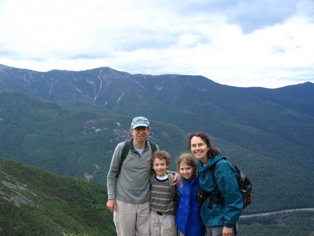
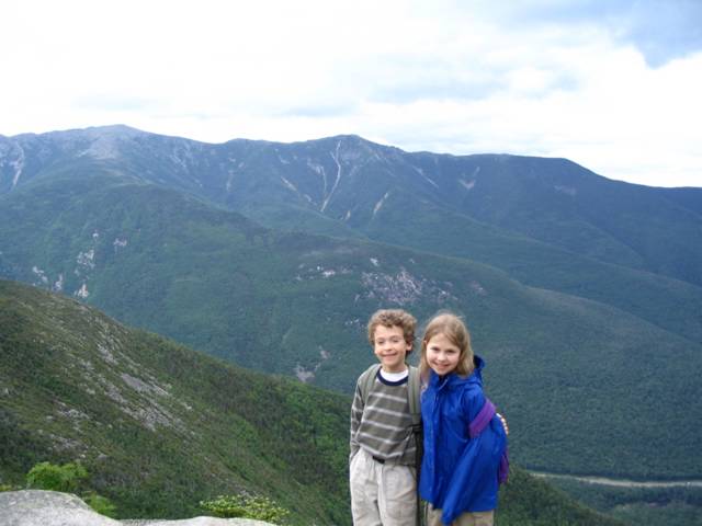
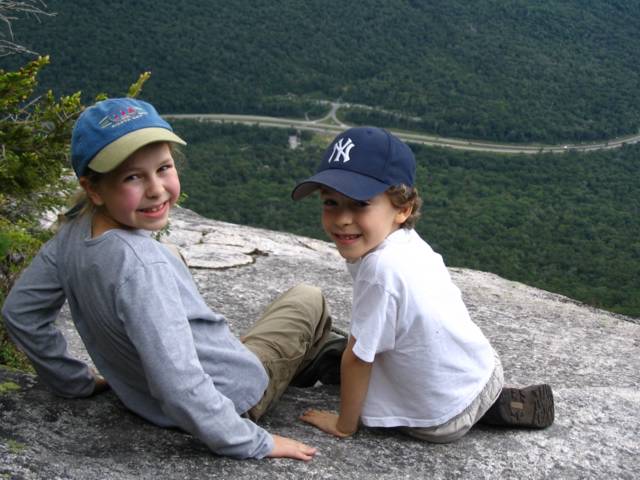
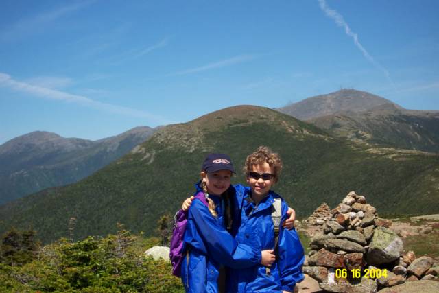
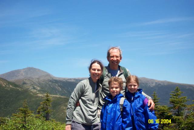
Our first hike of the summer was to Mt. Pierce in the southern Presidentials. Why Pierce? First, it is a 4000 footer - our son Jordan has a goal to climb all forty-eight 4000 footers and we have taken this on as a family project. As importantly for a first hike of the season, it is a moderate one - 6.4 miles, a total climb of 2400 feet and a trail that is not too rugged.

A good part of the hike is on, as the Tappett brothers would say, the "historic and folkoric" Crawford Path. The path was built in 1819 by Abel and Ethan Allen Crawford and is the oldest continually used hiking trail in the United States. It runs about 10 miles to Mt. Washington and is a remarkably good trail. Why did the Crawfords build it? To increase tourism to their Crawford Inn which in its time had as guests 5 U.S. Presidents, Daniel Webster, Nathaniel Hawthorne and John Greenleaf Whittier among others. The path to this day is one of the most heavily traveled hiking trails in the United Sates and is a remarkable engineering feat.

By the end of the hike we could say that we had all we could have handled for the day. We were beat. But wait. Toward the end of the hike a solo hiker passed us and asked where we had hiked. We told him and then politely asked him where he had been. He tells us he started the day at the Appalachia parking lot. My head started spinning the numbers. I calculated that must be about 17 miles and 6 peaks away.

When we reached the trailhead I quickly realize he is part of a group of hikers that range in age from about 45 to 65. I asked did you stay overnight at a hut (there are mountain huts operated by the AMC) or did you a complete this in one day? I really knew the answer already but needed to have it confirmed. The answer: "One day - 20 miles, 7000 feet of climbing, we started at 5:30am." Incredibly they looked more rested than we did. They didn't add, but I can, that the terrain and trails they had traveled are incredibly rugged. This would be a incredible feat for most anyone but for a 65 year old it is simply amazing and inspiring.

When we returned to the car, Deborah looked at me and said: "I can see that look at your eyes, you're considering the possibilities!" Indeed I was, that type of incredible feat is far beyond our current capabilities but to entertain new possibilities is indeed inspirational.

Distance: 6.4 miles. Climb 2400 ft. Elevation 4310 ft.