Sunday, July 31, 2005


The sun sets as we exit the trail at the Cog lot with our car still a bit down the road at the new trailhead. Posted by Picasa

Looking at the Southern Presidentials from the Jewell trail. Posted by Picasa

Junction of the Jewell and Gulfside trails. Posted by Picasa

The Gulfside trail close to Mt. Clay. Posted by Picasa

Another view of the Great Gulf. Posted by Picasa

The Great Gulf!! Posted by Picasa

The Great Gulf awaits ahead. Posted by Picasa

Kate and Jordan scamper ahead. Posted by Picasa

Just below the summit on the Gulfside trail we get grand views (for the next almost 2 hours) of the Great Gulf and Mt. Jefferson, Adams and Madison.
 Posted by Picasa

The cog-railroad (operating since 1869) leaves the summit. Posted by Picasa

Not your normal summit view with the observation deck in the background. Posted by Picasa

One more looking back at the hut and Monroe and Eisenhower. Posted by Picasa

Again looking back on the Crawford Path. Posted by Picasa

Looking back on the Crawford Path we see Mt. Monroe, the Lake of the Clouds Hut and one of the "lakes of the clouds." Posted by Picasa

Kate and Jordan walk ahead on the Crawford Path. Mt. Washington and it observatory loom 1.5 miles and 1400 feet ahead. Posted by Picasa

Breaking above tree-line on the Ammonoosuc. Posted by Picasa

The Gem Pool on the Ammonoosuc Ravine Trail. Posted by Picasa

Mt. Washington July 30, 2005

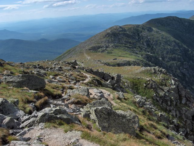
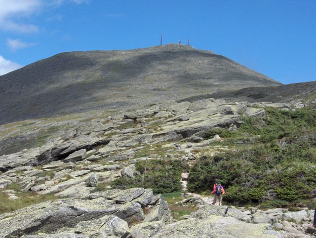
This was perhaps our grandest hiking adventure – a circuit hike of Mt. Washington that featured about 4 miles of above tree-line hiking with magnificent views on a clear day. The camera cannot even begin to capture the panorama we saw.

We climbed up the very steep Ammonoosuc Ravine Trail to Lake of the Clouds Hut and then took the historic Crawford Path to the summit. I took a frightening spill on a wet ledge on the Ammonoosuc but my out-of-control fall was fortunately braked by the sidewall of the ledge. Moral- stay off wet ledges on steep trails.

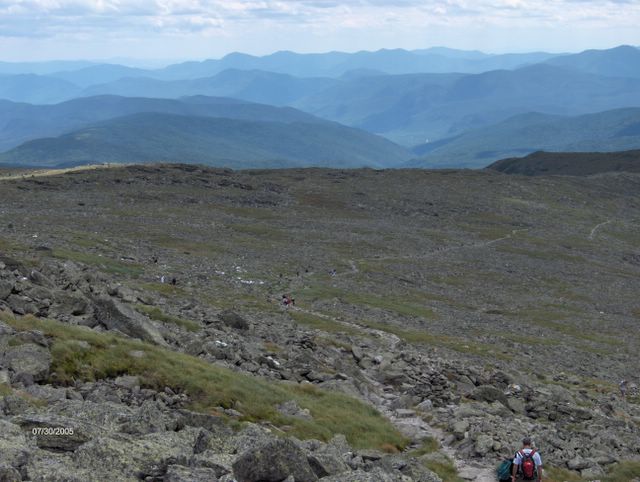
As the highest peak in the Northeast, Mt. Washington attracts its share of hikers who can't go the distance. The kids observed without judgment the many couldn't make it. It is not only the physical conditioning but importantly the psychological conditioning that comes from previous hiking challenges that gets you to the summit. Without that conditioning and knowing that you can put one foot in front of the other and endure, your ego may scream at you that you can't make it. The kids today saw how far they have come – not only was the physical challenge fairly easy for them but they were essentially not even challenged on the psychological side.

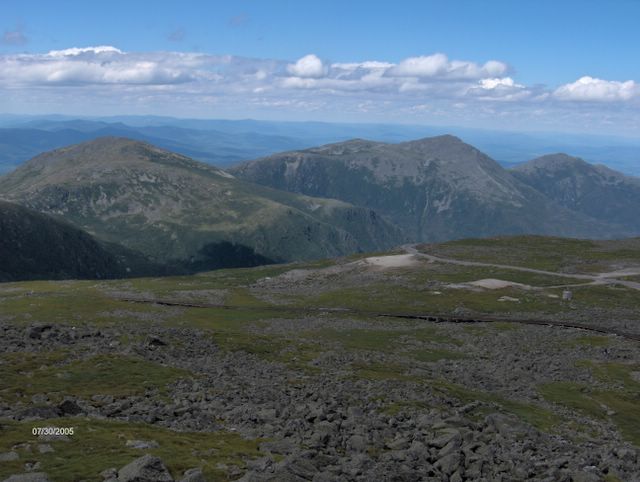
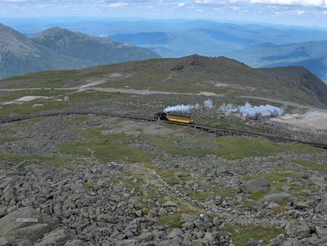
The summit is of course crowded with folks who arrived by auto-road or cog railroad. At 3pm it was 48 degrees at the summit with 21 miles an hour winds and 88 degrees and calm in the valley below.

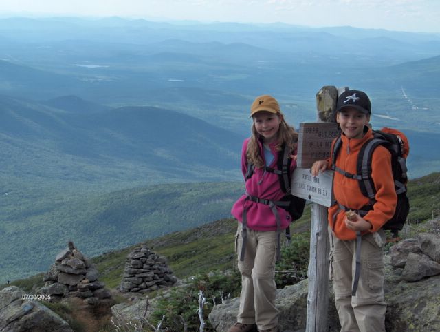
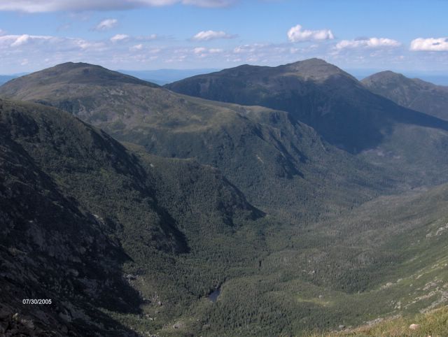
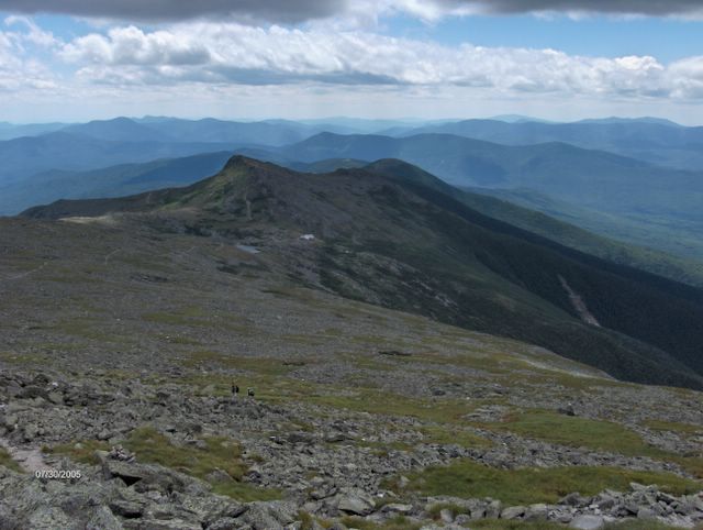
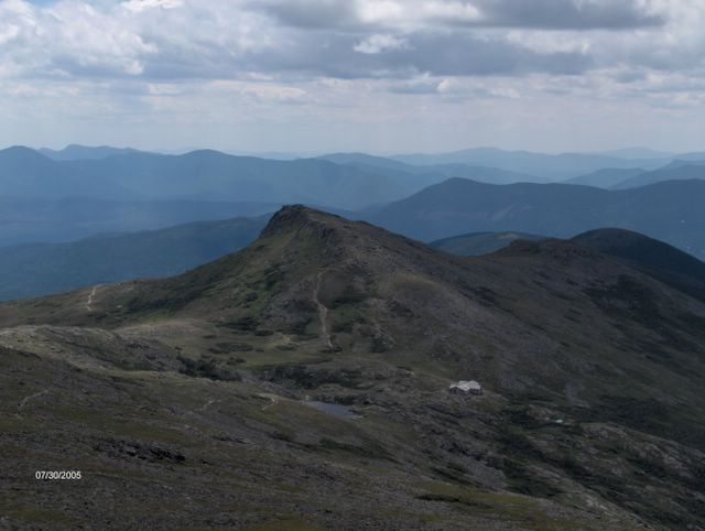
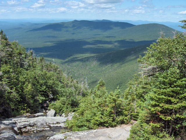
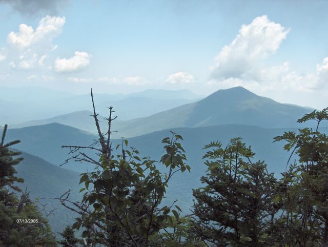
After the summit we hiked down the other side on the Gulfside trail. For almost 2 hours we had spectacular views of the Great Gulf and Mts. Clay, Jefferson, Adams and Madison. Then down the Jewell trail and out (because the bridge was out on the new trail) at the old trailhead at the Cog railroad. We exited the trail, shortly after 8pm, just as the sun was setting.

Distance 10 miles; Climb 3900 ft; Elevation 6288 ft.

Friday, July 22, 2005


Kate and the Canadian Wood Lilies. Posted by Picasa

Kate spotted rare Canadian Wood Lilies in a meadow, close to the end of the hike. Posted by Picasa

The North peaks looms about 1 mile from the end of a long day.  Posted by Picasa

Except for the bugs, which were thick today, after the slide the rest of the hike is a super woodlands walk. Posted by Picasa

The ski slopes on Tecumseh are about 8 miles away (from the bottom of the South slide)  Posted by Picasa

Only another 1000 feet on the slide to go. Who's idea was this anyway? :-) Posted by Picasa

At the top of the South slide. Posted by Picasa

From the Middle peak. Posted by Picasa